🌐 Around the World with Beyondia 🧵 Nordic & Western Europe Region 🪡 Episode 68: The Westfjords
The Westfjords (Vestfirðir, “West Fjords”) is one of the eight administrative regions of Iceland, occupying the large peninsula in the northwestern part of the country. The region covers approximately 22,000 square kilometres — 22% of Iceland’s total land area — but contains only approximately 7,100 residents, roughly 1.8% of Iceland’s national population. This makes it the least populated Icelandic region by both absolute numbers and density. Approximately 0.3 people per square kilometre is one of the lowest densities in Europe, comparable to Arctic regions of Norway, Sweden, and Finland. The region is connected to the rest of Iceland by a narrow isthmus 7 kilometres wide at Gilsfjörður — a geographical feature that has shaped the region’s character throughout history, providing isolation and autonomy of cultural development. The consequence: the Westfjords has preserved rural Icelandic character that has been transformed elsewhere by the 20th-century migration to Reykjavík.
Westfjords is Geologically Dormant
The geological character is worth naming carefully. Most of Iceland — the central and southern regions where volcanism continues — formed geologically recently through Mid-Atlantic Ridge activity across the past 3 million years. The Westfjords predate this. The rocks of the Westfjords date to approximately 16 million years ago, during the Miocene epoch, when the mid-ocean spreading axis was in a different position. Subsequently the spreading axis shifted eastward to its current position through central Iceland, leaving the Westfjords west of the active volcanic zone. The consequence: the Westfjords is geologically dormant. No active volcanoes. No substantial geothermal fields (a handful of small hot springs exist but nothing comparable to Reykjavík’s district heating infrastructure or the Golden Circle’s Geysir area). No active volcanic hazards. The landscape that visitors experience was shaped by glacial action across the past 2.5 million years, particularly during the last major glaciation (115,000 to 12,000 years ago) when ice sheets carved the fjord system that defines the region.
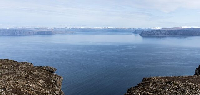
The fjords are one of the great fjord landscapes in Europe. Approximately 30 major fjords carve into the peninsula, with mountains rising to 900 metres between them, dramatic sea cliffs on the outer coasts, and deep-water channels providing natural harbour infrastructure. The major fjords include Ísafjarðardjúp (the largest fjord system, containing the administrative centre Ísafjörður), Arnarfjörður (a dramatic fjord on the southern coast containing the Dynjandi waterfall), Dýrafjörður (the setting of Gisli’s Saga), Patreksfjörður, and dozens of smaller fjords. The landscape has been compared to the Norwegian fjords, particularly the Sognefjord and the western Norwegian fjord systems — the comparison is accurate, both regions shaped by similar glacial processes acting on similar geological substrate. The difference: the Norwegian fjords are more accessible, with road infrastructure, cruise ship tourism, and populations along the coasts. The Westfjords is more remote, less developed, and less visited.
The Norse settlement began during the 9th-10th century Icelandic settlement period. The Landnámabók (Book of Settlements, compiled 12th century) documents Norse settlers arriving in the Westfjords from approximately 900 AD onwards, establishing farms in fjord-head locations that provided arable land, fresh water, and access to fishing waters. The settlement pattern that emerged — small farms distributed along the fjord coasts, communities organised around the fjord as the primary geographical unit — has remained unchanged for approximately 1,100 years. Modern Westfjords settlements continue to be organised around fjords, with towns and villages sitting at fjord heads or at harbour locations along the coasts.
Gisli’s Saga (Gísla saga Súrssonar) — one of the Icelandic sagas, composed approximately 1250-1300 AD documenting events 940-980 AD — is set in Dýrafjörður and Arnarfjörður. The saga documents the tragic life of Gísli Súrsson, an outlaw declared outside the law at the Althing following a killing, who lived on the run for approximately 13 years in the fjords and mountains of the Westfjords before being killed in 977 AD. Gisli’s Saga is among the finest of the Icelandic sagas — its poetry, psychological complexity, and character development have been compared to Greek tragedy in literary criticism. The landscape can still be walked with the saga text in hand. The farm at Hóll where Gísli lived, the hiding places where he took refuge during his outlaw years, the location where he was killed, and other landmarks are identifiable in the modern landscape. This continuity between medieval literary text and contemporary geography is one of the more remarkable literary-geographical continuities in modern Europe. Very few medieval European literary texts can still be walked in the landscapes where the events they document actually occurred.
The 1615 Spanish massacre — Spánverjavígin, “the Spanish killings” — is one of the darker events in Icelandic history. In the summer of 1615, three Basque whaling ships from ports including San Sebastián and Bilbao had been working the North Atlantic whaling grounds off Iceland when a severe storm on 19 September 1615 destroyed all three ships in Reykjafjörður in the northern Westfjords. Approximately 83 Basque whalers survived the shipwrecks and reached shore. What happened next is one of the tragic events in Icelandic history.
The Basque whalers were foreign — Catholic, from enemy nations (Spain and France were in various states of conflict with Denmark), speaking a language incomprehensible to the Icelanders. The Danish crown had issued a royal decree in 1615 declaring foreign whalers who came ashore in Iceland to be outlawed — meaning Icelanders could kill them without penalty. The local Icelanders, impoverished and resentful of foreign presence, acted on the decree. In three separate incidents between 5 October and 12 October 1615, approximately 32 Basque whalers were killed by groups of Icelandic farmers under the leadership of Sheriff Ari Magnússon of Ögur. The killings included documented cruelty: whalers killed while sleeping, others hunted through the mountains, dead bodies mutilated. Approximately 51 Basque whalers escaped and eventually made their way home to Basque country, providing documentation of the events through their accounts.
The 1615 events were forgotten in mainstream Icelandic historical memory for centuries, but preserved in Basque historical accounts and West Fjords local folk memory. In the late 20th and early 21st centuries, historical research rehabilitated the memory of the events. In 2015, on the 400th anniversary of the massacres, West Fjords district commissioner Jónas Guðmundsson issued a formal apology on behalf of Iceland to the Basque community. Reconciliation ceremonies were held with representatives from the Basque country. The formal legal decree that had allowed the killings — which had remained technically in force for approximately 400 years — was formally rescinded in 2015. The events have been increasingly acknowledged in Icelandic public discourse as one of the darker events in Icelandic history that required reckoning.
Westfjords Development
Beyond the saga heritage and the 1615 massacre, the historical Westfjords developed through the medieval Icelandic Commonwealth period, the Norwegian and Danish sovereignty periods, and the 19th-20th century Icelandic national revival covered at Reykjavík Ep 67. The region maintained rural character throughout, with fjord communities organising around fishing (cod, herring, other Atlantic species) and limited pastoral agriculture (sheep, some cattle in the fjord-head lowlands). The Danish trade monopoly (1602-1787) restricted Westfjords commerce to Danish merchants operating from trading posts including Ísafjörður.
The 20th century brought economic and demographic transformation. The Westfjords population peaked at approximately 13,500 in the 1940s, then declined across the subsequent decades — reaching approximately 10,000 by 1990, 8,500 by 2005, and 7,100 today. The decline was driven by mechanisation of the fisheries (which reduced employment in traditional fishing), migration to Reykjavík (which offered higher wages and urban opportunities), infrastructure challenges (the Westfjords remained disconnected from the national road network until the late 20th century), and rural depopulation patterns common across European rural regions. Many Westfjords villages that were populated in 1950 are now depopulated or reduced to handfuls of residents.
The most dramatic case was Hornstrandir — the northernmost region of the Westfjords, inhabited by approximately 500 people in the early 20th century. Harsh conditions, isolation, lack of infrastructure, and demographic pressures drove all residents to abandon the region during the 1940s-1950s. The last permanent resident left in 1952. The area was designated a nature reserve in 1975 and now covers approximately 580 square kilometres of uninhabited landscape. Hornstrandir is accessible only by boat during summer months (June through August), and provides extended hiking terrain, Arctic fox populations (approximately 500 individuals, one of the highest concentrations in Iceland), seabird colonies, and dramatic coastal scenery. The abandonment of Hornstrandir represents one of the cases of complete rural depopulation in modern European history, and the preserved landscape provides insight into what Westfjords rural life looked like before 20th-century transformation.
Westfjords Tourism
Westfjords tourism developed in the 1990s and 2000s as part of the broader Icelandic tourism boom that followed the 2008 financial crisis. Approximately 60,000 international visitors reach the Westfjords annually — a fraction of the approximately 2 million total international visitors to Iceland (most of whom concentrate on the Golden Circle within an hour of Reykjavík). The Westfjords visitors are those seeking remoteness, dramatic landscape, and an alternative to the mass-tourism Golden Circle experience.
Látrabjarg is the bird cliff at the westernmost point of Iceland (and one of the westernmost points of Europe, approximately 24.5 degrees west longitude), 14 kilometres long and up to 441 metres tall. The cliffs contain one of the largest bird colonies in Europe, with approximately 40% of the world’s razorbill population (approximately 220,000 breeding pairs), Atlantic puffin colonies (approximately 200,000 pairs), common guillemot colonies (approximately 130,000 pairs), Brünnich’s guillemot colonies, fulmar colonies, and other seabird species. The cliffs are accessible on foot from the end of the road at Bjargtangar lighthouse, and summer visitors can observe puffins at close range as the birds nest in burrows in the cliff-top grass.
Dynjandi is the waterfall on Arnarfjörður, cascading approximately 100 metres in a fan-shaped series of drops. The waterfall has been compared to a bridal veil — water widens from approximately 30 metres at the top to 60 metres at the bottom — and consists of seven distinct waterfalls in the complex: the main Dynjandi (Fjallfoss) at 100 metres, plus smaller waterfalls (Hundafoss, Strompgljúfrafoss, Göngumannafoss, Hrísvaðsfoss, Bæjarfoss, Sjóarfoss) below. Dynjandi is one of the iconic Icelandic waterfalls but less visited than the Golden Circle waterfalls due to remoteness.
Rauðasandur (“Red Sand”) is the 10-kilometre beach on the southern Westfjords coast, with reddish-orange to pinkish sand — colouration derived from calcareous algae and pulverised scallop shells rather than volcanic material. The colouration distinguishes Rauðasandur from the black volcanic sand beaches that characterise most Icelandic coastlines. The beach is remote — accessed via a gravel road that descends steeply from the main road — and uncrowded even during peak tourism season.
Ísafjörður — the administrative and cultural centre of the Westfjords — has a population of approximately 2,700 and functions as the service centre for the region. The town sits at the head of a narrow fjord (Ísafjarðardjúp), with mountains rising directly behind the town to approximately 600 metres. The historic character includes 19th-century wooden buildings in the old harbour area, the Westfjords Heritage Museum (documenting regional maritime and fishing history), an active fishing harbour, and a small University of Iceland Westfjords campus. The town hosts annual events including the Aldrei fór ég suður music festival (established 2004, held during Easter weekend, one of the Icelandic music festivals held outside Reykjavík).
The contemporary Westfjords economy depends on fisheries (cod, haddock, saithe, and shellfish including the Icelandic scallop and langoustines), aquaculture (salmon farming has expanded in recent decades — approximately 60,000 tonnes annual production, though controversially with environmental concerns about impact on wild salmon populations and fjord ecosystems), tourism (approximately 60,000 international visitors annually, plus domestic Icelandic tourism), limited agriculture (primarily sheep farming), and public sector employment. The ongoing tensions include population decline (with consequences for service provision, school and healthcare infrastructure, and community sustainability), infrastructure challenges (the road network is incomplete, with mountain passes closed for portions of the winter and alternate routes required), salmon farming disputes (environmental advocacy opposes expansion), and balancing rural character preservation with economic development needs.
The salmon farming expansion is one of the most contested current issues. Salmon farms in Westfjords fjords have expanded production but produce environmental concerns including escaped farmed salmon threatening wild salmon genetic diversity, concentrated waste impacting fjord ecosystems, and sea lice infestations. The tension between economic development (salmon farming provides employment in communities with population decline) and environmental protection (wild salmon populations and fjord ecosystems) is an ongoing Icelandic political debate. The population decline is an existential concern — individual villages have become unsustainable as populations have fallen below thresholds for service provision, and ongoing government policy attempts to support rural retention through economic incentives and infrastructure investment.
The Westfjords is one of the rural European regions where traditional rural culture, medieval literary heritage (Gisli’s Saga set in landscape still walkable), and dramatic natural landscape remain preserved as living reality rather than performed tourism attraction. The Norse settlement began 1,100 years ago and the fjord-based community pattern has not fundamentally changed. The saga literature composed 800 years ago can still be walked in the landscape it documents. The bird cliffs at Látrabjarg host 40% of the world’s razorbill population. The waterfall at Dynjandi cascades 100 metres in a seven-tier fan. The Hornstrandir peninsula has returned to something close to its pre-human state after complete abandonment in 1952. Approximately 7,100 people continue to live here, in one of Europe’s emptiest regions, in landscape that predates most of Iceland by 13 million years.
Some rural regions have been transformed by 20th-century development. This one has been transformed by 20th-century depopulation — 40% population loss from the 1940s peak, complete abandonment of the Hornstrandir peninsula, ongoing pressures on remaining communities. The consequence is that the Westfjords is one of the rural European regions where the traditional way of life, the medieval literary inheritance, and the dramatic natural landscape remain preserved as living reality. Very few European rural regions carry this accumulated inheritance. Very few remain this remote and this unvisited.
Nine regions. One hundred and twenty destinations. Two hundred and ninety-three weeks remaining.
The journey continues east across Iceland. The next stop is the Golden Circle route from Reykjavík — the 300-kilometre driving circuit connecting the constitutional site where the world’s oldest parliament was established at 930 AD, the geothermal area that gave the English word “geyser” its name, and one of the iconic Icelandic waterfalls.
Where are you going?

Beyondia
Trusted Travel CompanionReal digital nomad. I travel. I learn. I grow.
What about you? Where are you going?