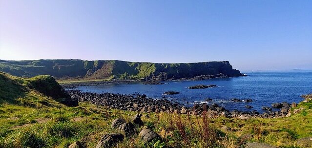
Route: Dublin → Doolin (County Clare) → Dingle (County Kerry) Total distance: approximately 550 km Driving time: approximately 7–8 hours (spread over 5–7 days) Road: M7/M18 west to Clare, then the Wild Atlantic Way south to Kerry Currency: Euro (€) Driving side: Left Best months: May–June, September
The Shape of This Route
Ireland is not a Mediterranean country. Nothing about it behaves like the ten countries that came before. The light is different — filtered through cloud, arriving sideways, soft enough to photograph anything without harsh shadow and grey enough to make you doubt photography altogether. The wind is permanent. The rain is not weather but identity. The coast is not a boundary between land and sea — it is a negotiation, ongoing, violent, and the Atlantic is winning.
This route moves from east to west: from Dublin, where history is stored and displayed, across the limestone interior to the west coast, where history is carved into the cliffs and the stone walls and the empty villages and the music that is played in the same pubs every night as if repetition were a form of survival. The Wild Atlantic Way — a 2,500 km marked coastal route running the entire western seaboard — connects Doolin and Dingle along the most dramatic stretch of coastline in Northern Europe.
Three stops. The cultural capital, the musical village, the Gaelic-speaking peninsula. One country that looked west across the Atlantic and, unlike Portugal, did not send ships toward the horizon — it sent people, forced out by famine, and the culture that survived the emptying is what you drive through now.
Dublin — The Cultural Gateway
Dublin is compact, walkable, literary, and wet. The city sits on the Liffey, which divides north from south in a way that Dubliners will explain to you at length and that visitors will not notice. The south side holds the tourist centre — Trinity College, Grafton Street, Temple Bar, St Stephen’s Green. The north side holds the General Post Office, where the 1916 Easter Rising began, and a grittier, less polished energy that the south side respects and does not replicate.
Trinity College and the Book of Kells are the anchor. The Book of Kells is a ninth-century illuminated manuscript of the four Gospels, produced by monks likely on the Scottish island of Iona and brought to Ireland to protect it from Viking raids. It is one of the finest examples of medieval manuscript art in existence — every page hand-painted with interlocking patterns, mythical animals, and decorated letters that require magnification to fully appreciate. Two volumes are on permanent display; the pages on view are changed periodically for conservation. Adult tickets approximately €26, timed entry, book well in advance — this is Dublin’s most visited attraction and summer queues are severe.
The exhibition leads into the Long Room — Trinity’s eighteenth-century library hall, 65 metres long, lined with 200,000 of the oldest volumes in the collection. The barrel-vaulted ceiling and rows of marble busts create one of the most photographed interiors in Ireland. Note: the Long Room has been undergoing restoration — check current access status and whether the books are on shelves or temporarily removed.
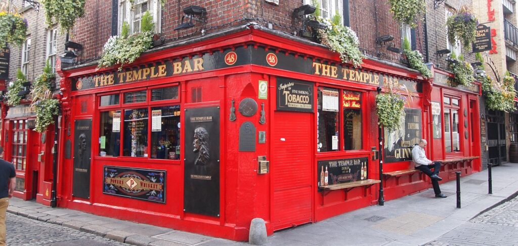
Temple Bar is Dublin’s cultural quarter — cobbled streets, pubs with live music sessions every night, street performers, and restaurants. It is touristy, it is aware of being touristy, and the traditional music sessions in pubs like The Temple Bar, Oliver St. John Gogarty, and The Auld Dubliner are real musicians playing real trad for a crowd that includes both tourists and locals. Go in the evening. Sit near the musicians. Order a pint and do not talk over the music.
The Guinness Storehouse occupies the old fermentation building at St James’s Gate brewery and is Ireland’s most visited tourist attraction. The self-guided tour traces the history and production of Guinness through seven floors, ending at the Gravity Bar — a glass-walled rooftop where your ticket includes a complimentary pint and a 360-degree view of Dublin. Tickets approximately €26 for adults, book online. The experience is polished, commercial, and worth it if you understand that you are visiting a brand temple and enjoying it on those terms.
Stage One — Dublin to Doolin
Distance: approximately 280 km Driving time: 3.5–4 hours via M7 and M18
Leave Dublin heading west on the M7 toward Limerick, then the M18 north into County Clare. Ireland’s motorways are well-maintained, toll-free on this stretch, and fast. The landscape changes within an hour of Dublin — the flat midlands give way to open farmland, stone walls appear along field boundaries, and the sky widens as the urban density falls away.
Ireland drives on the left. If you are arriving from continental Europe, this is the adjustment. Roundabouts circulate clockwise. Rural roads in Clare and Kerry are narrow, hedge-lined, and shared with tractors, sheep, tour buses, and oncoming traffic that expects you to pull into a passing place without negotiation. Speed limits on rural roads are posted in kilometres per hour and are aspirational rather than achievable.
Doolin — The Heart of the Music
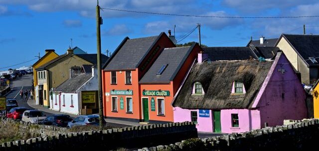
Doolin is a village of approximately 200 people that functions as the unofficial capital of Irish traditional music. Three pubs — McGann’s, Fitzpatrick’s, and Gus O’Connor’s — host live trad sessions nightly, year-round. The music is not staged. It is not a performance for tourists, though tourists are present and welcome. It is a session — musicians gathering with instruments, playing tunes they have all learned from the same tradition, taking turns leading, joining in, dropping out. The session is the format. The pub is the venue. The tradition is the point.
This is the music that survived the famine. The musicians who emigrated carried it to Boston, New York, Chicago, London. It crossed the Atlantic in the same ships as the people, and it came back changed — influenced by American country, by jazz, by the recording industry — but the core survived: fiddle, flute, tin whistle, bodhrán, uilleann pipes, concertina. The tunes have names. The tunes have histories. The tunes are played in Doolin on a Wednesday night in a pub with a fire burning in the same way they were played a hundred years ago, and no one considers this a museum. They consider it a Tuesday.
The Cliffs of Moher are an 8 km walk from Doolin along the coastal trail — or a short drive to the visitor centre car park. The cliffs rise 214 metres above the Atlantic and stretch for 14 km along the Clare coast. The visitor centre has parking (paid), exhibitions, and managed viewing platforms. But the walk from Doolin along the cliff path is the better approach — the scale builds gradually, the wind is constant, and the absence of guardrails on much of the path reminds you that this is not a viewing platform. It is a cliff. Bring rain gear. The weather changes in minutes.
Doolin Cave — a short drive from the village — contains one of the longest free-hanging stalactites in the world, a 7.3-metre formation in a chamber that took 350,000 years to create. Guided tours last approximately 45 minutes.
Aran Islands: Doolin pier is a departure point for ferries to the three Aran Islands — Inis Mór (the largest), Inis Meáin, and Inis Oírr. The islands are Irish-speaking, treeless, wind-scoured, and crossed with the densest network of stone walls in Ireland. Dún Aonghasa on Inis Mór — a prehistoric stone fort on the edge of a 100-metre cliff — is among the most dramatic archaeological sites in Europe. Ferries operate March through October, foot passengers only from Doolin. Book in advance during summer.
Stage Two — Doolin to Dingle
Distance: approximately 180 km Driving time: 3.5–4 hours via Lahinch, the ferry at Killimer/Tarbert, and Tralee
The road south from Doolin follows the Clare coast before crossing the Shannon estuary by car ferry (Killimer to Tarbert, approximately 20 minutes, runs year-round, approximately €20 one way for a car). The alternative is a long inland detour via Limerick. Take the ferry — it saves an hour and the estuary crossing is its own experience.
From Tarbert, the road continues south through North Kerry and into the Dingle Peninsula — the landscape becoming more dramatic, the signs becoming bilingual and then fully Irish, and the Atlantic light shifting from Clare’s grey-white to Kerry’s grey-green as the peninsula narrows toward Europe’s western edge.
Dingle — The Edge
Dingle (An Daingean) sits on the north side of a deep natural harbour at the western end of the peninsula. It is a fishing port, a tourist town, and one of the strongest Gaeltacht areas in Ireland — a place where Irish is the first language of daily life, not a heritage exercise. The street signs are in Irish. The conversations in the shops switch between Irish and English without announcement. The pubs host sessions where songs are sung in Irish and nobody translates, because the music carries the meaning the words carry and the meaning does not require translation.
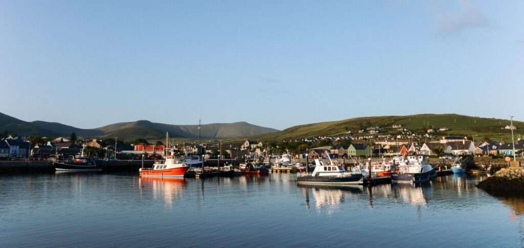
Slea Head Drive is the reason Dingle functions as a destination. A 47 km circular route starting and ending in Dingle town, it follows the western tip of the peninsula along cliff roads with views of the Blasket Islands, the Atlantic, and some of the oldest archaeological sites in Ireland. Beehive huts (clocháns) — dry stone structures that have stood for over a thousand years using the same construction principle as the Joanina Library: stone fitted so precisely that no mortar is needed and no water enters. The Gallarus Oratory — an early Christian church built entirely of dry stone, watertight after twelve centuries — sits a few kilometres from Dingle and looks like a stone boat turned upside down. Access is free via a public path.
Dingle’s food scene is concentrated and excellent. Fresh seafood from the harbour — landed that morning, served that evening. Murphy’s Ice Cream — a local institution using Irish milk and sea salt, with flavours like Dingle gin, brown bread, and Irish coffee — is the kind of specific, place-rooted food that GoBeyondia Food was built to celebrate. Fish and chips from a harbour-front shop. Chowder in a pub with a fire. The food in Dingle tastes like the sea because the sea is fifty metres from every kitchen.
Practical Notes
Driving: Ireland drives on the left. Motorways (M roads) are fast and well-signed. National roads (N roads) are good. Regional roads (R roads) and local roads in Clare and Kerry are narrow, winding, and shared with agricultural traffic. Rental cars are available at Dublin Airport and in all major towns. Manual transmission is standard; request automatic in advance if needed.
Tolls: The M50 Dublin ring road has an electronic toll (eFlow) — if driving a rental, confirm whether the car is registered. Most other roads on this route are toll-free.
Weather: It will rain. Accept this. Pack layers and waterproof outerwear. Irish weather changes multiple times per day — locals describe a good day as “soft,” which means it is raining gently. The west coast is wetter and windier than Dublin. May and June are the driest months and have the longest daylight (sunset after 10 PM in June). September is warm and quieter. July and August are peak tourist season with corresponding crowds on the Cliffs of Moher and Slea Head Drive.
Music: Traditional music sessions happen nightly in Doolin and Dingle, and several nights a week in Dublin’s Temple Bar and Cobblestone pub (north side). Sessions are free — you buy your drinks, you sit, you listen. Do not clap between tunes in a set — wait for the set to finish. Do not request songs. This is not a jukebox. It is a tradition.
Language: English is spoken everywhere. Irish (Gaeilge) is the first official language and is the community language in Gaeltacht areas including the Dingle Peninsula and the Aran Islands. Road signs in Gaeltacht areas are in Irish only. Dingle appears on maps but the official road signs say An Daingean. This is not confusing once you know it, and it is very confusing if you don’t.
Food: Dublin is international and expensive. Doolin is pub food and seafood — simple, honest, portions large. Dingle is the food highlight: fresh-caught fish, artisan producers, and the kind of culinary identity that happens when a town has a harbour and a tradition and enough tourists to support restaurants that take both seriously.
Budget: Ireland is not cheap. Dublin hotel prices rival London. Accommodation in Clare and Kerry is more affordable but books out quickly in summer. A pint of Guinness costs approximately €5.50–7.00 depending on the pub and location. Main courses in restaurants run €15–25. The Cliffs of Moher visitor centre parking is approximately €8.
What This Route Is Really About
This route moves from the place where history is preserved to the place where history is still being lived. Dublin stores the Book of Kells in a climate-controlled case and charges €26 to see it. Dingle stores its language in the conversations at the shop counter and does not charge anything. Both are acts of preservation. Both are necessary. The difference is that one requires a ticket and the other requires your ears.
Ireland’s west coast is what remains after the emptying. The famine, the emigration, the economic collapse that depopulated the countryside and sent millions across the Atlantic — all of that happened, and the stone walls are still standing, and the music is still playing, and the Irish language is still being spoken on a peninsula where the next parish west is Boston.
The Wild Atlantic Way is not a scenic drive. It is a scar that healed into a coastline. The cliffs are beautiful in the way that survival is beautiful — not decorative, not designed for admiration, but still here. Still standing. Still being rained on. Still answering.

Beyondia
Trusted Travel CompanionReal digital nomad. I travel. I learn. I grow.
What about you? Where are you going?