🌐 Around the World with Beyondia 🧵 Mediterranean Region 🪡 Episode 48: Gran Canaria
Gran Canaria is the third-largest of the seven Canary Islands — 1,560 square kilometres, roughly the size of the American state of Rhode Island — and sits approximately two hundred kilometres off the Moroccan coast, at the same latitude as the western Sahara. It has a permanent population of approximately 855,000 residents, most of them concentrated in the capital Las Palmas de Gran Canaria on the northeastern coast, and it receives approximately four and a half million tourists per year, the second-largest single visitor share of any Spanish island after Tenerife.
Gran Canaria is a single roughly-circular volcanic mass
Geologically, the island is a single roughly-circular volcanic mass, approximately 45 kilometres across at its widest point, rising from a central peak at Pico de las Nieves (1,949 metres above sea level) and sloping outward in every direction to the coast. Volcanic eruptions built the island in three main phases, beginning approximately 14 million years ago and continuing sporadically until roughly 2,000 years ago — the most recent eruption, dated by radiocarbon analysis, occurred around 2,050 years ago from vents in the central highlands. The island is currently classified as dormant but not extinct, monitored by the Instituto Volcanológico de Canarias.
The most striking feature of the island’s geography is not the volcano at its centre but the diversity of its slopes. Because Gran Canaria rises steeply from the sea in every direction, and because the northeast trade winds bring moist Atlantic air to the northern and northeastern coasts while leaving the southern and western coasts in a rain shadow, the island contains a genuine microcontinental climate range in the space of a single 60-kilometre north-to-south transect. The northern coastal plain — around Gáldar, Guía, Arucas, and Bañaderos — is subtropical, with average January temperatures of 18°C, annual rainfall of over 1,000 millimetres, and agriculture centred on bananas, sugar cane historically, and coffee at higher elevations. The northern midlands, between 500 and 1,000 metres, are temperate and green year-round, with pine forests, chestnut groves, and traditional agricultural terraces. The central highlands, between 1,000 and 1,900 metres, are alpine in character, with winter frosts, occasional light snowfall on Pico de las Nieves, and vegetation dominated by Canary Island pine (Pinus canariensis, a fire-adapted endemic species that survives volcanic eruption and forest fire by resprouting from carbonised bark). The western slopes, in the rain shadow of the central peaks, are semi-arid, with cacti, agaves, and drought-adapted shrubs. The southern coast is hot and dry, with less than 100 millimetres of annual rainfall in some areas — a rainfall figure comparable to inland Egypt — and at the southernmost tip, an active desert ecosystem of migrating sand dunes covers approximately four hundred hectares. Six ecosystems, six climate zones, one island. The Canary Islanders call this configuration un continente en miniatura — a continent in miniature. The claim is not tourism-board hyperbole. The claim is meteorological description.
Gran Canaria contains a comparable diversity in a landmass one-sixth the size
The Big Island of Hawaii, which contains eleven of the world’s fifteen recognised climate zones across 10,000 square kilometres, is the reference case for this phenomenon in North American geography classrooms. Gran Canaria contains a comparable diversity in a landmass one-sixth the size. The mechanism is essentially identical — steep volcanic island slopes, prevailing moist marine winds interacting with elevation and orientation, distinct climate zones stacked vertically and horizontally within a small footprint — and the ecological result is that a hiker who starts at sunrise on the banana plantations of Bañaderos and drives to sunset at the Maspalomas dunes has crossed through six climate zones in a single day. The island’s traditional cultures reflect the ecological diversity. The northern coastal towns have a banana-water agricultural identity going back to sixteenth-century sugar plantation economics. The interior mountain villages of Tejeda, Artenara, and Ayacata have a chestnut-goat-cave-dwelling identity going back to pre-Hispanic Canarii settlement patterns. The southern towns have irrigation-agriculture-and-fishing identities that were substantially transformed by tourism development from the 1960s onwards but retain roots in earlier Berber-inflected pastoral economies. The island is not one culture. The island is four cultures on the same volcanic rock, occupying different climatic zones, connected by roads that were substantially not built until the 1960s.
The dunes at Maspalomas, on the southern tip of the island, are the article’s most striking single landscape. Approximately four hundred hectares of active sand dunes, some reaching twelve metres in height, migrate at a rate of several metres per year in response to the constant northeast trade winds that blow across the exposed southern peninsula. The dunes have been protected as a Reserva Natural Especial since 1994, and function ecologically as a semi-arid coastal desert ecosystem with specialised endemic plant species (Traganum moquinii, a salt-tolerant shrub that stabilises dune margins), migratory bird populations, and a coastal freshwater lagoon (the Charca de Maspalomas) that serves as a critical stopover for European-African bird migration. The dunes are visible from the beaches of Maspalomas and Playa del Inglés — the two most-visited beaches on the island, absorbing approximately 60% of the island’s total tourism accommodation — and they occupy an area that would, in any other continental context, be classified as a genuine desert. The Spanish tourism board describes Maspalomas as “Europe’s only urban desert.” The description is broadly accurate: no other European Union territory contains an active sand-dune desert ecosystem of this scale within twenty-five kilometres of a major city.
The origin of the sand is more interesting than the popular explanation suggests, and the article should handle it honestly. For most of the twentieth century, the standard explanation among tourism guides was that the Maspalomas sand had been transported across the Atlantic from the Sahara by trade winds and ocean currents — a satisfying narrative that connected European tourists to African geography and made the dunes feel like a piece of the Sahara that had crossed the sea. The reality is more complicated. Recent geological and geochemical analysis, particularly work published by researchers at the University of Las Palmas de Gran Canaria in the 2000s and 2010s, has established that the majority of the Maspalomas sand is of local marine origin — pulverised shell and coral fragments from the Canarian seabed, mineral sediment from the erosion of the surrounding volcanic rock, and organic material broken down by wave action, all deposited over millennia by the combined action of ocean currents, tidal patterns, and coastal wind uplift. The calima — the periodic Saharan dust storms that do reach the Canaries several times per year and blanket the islands in an orange atmospheric haze — carries genuine Saharan mineral dust to the archipelago and contributes to the sand composition, but does not account for the bulk of the Maspalomas deposit. The dunes are, geologically speaking, primarily Canarian rather than Saharan. The active desert ecosystem, the migration patterns, the endemic vegetation, the coastal ornithology, and the visual effect of an African-looking sandscape twenty-four kilometres from a European city — all of that is real, regardless of the sand’s source. The popular Saharan-origin story is partly wrong. The geological Canarian-origin story is more scientifically interesting. The ecological reality of an active European desert ecosystem is unusual either way.
Las Palmas de Gran Canaria — the largest city in the Canaries
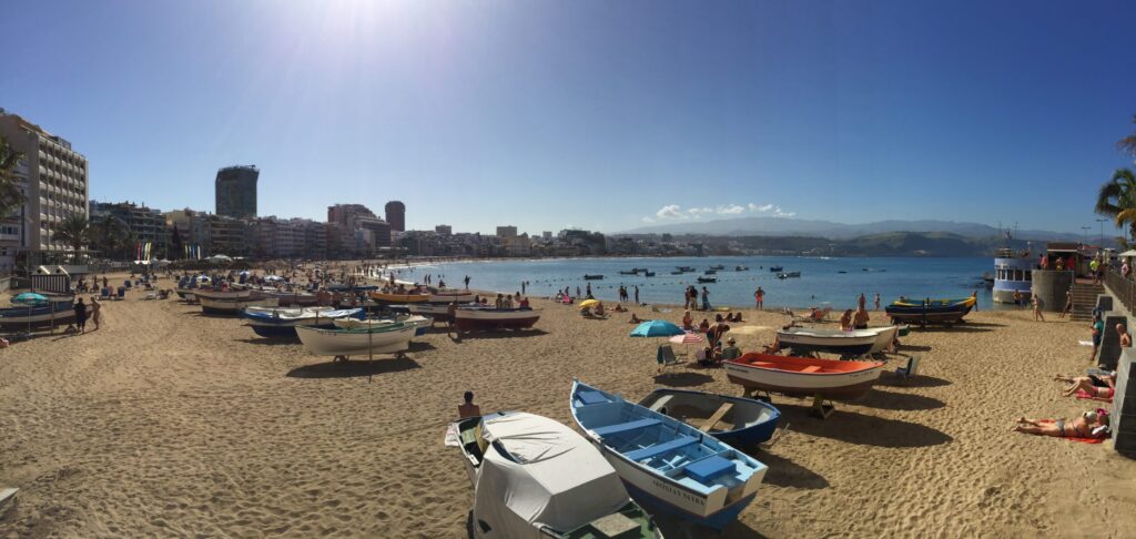
Twenty-four kilometres north of the dunes, on the opposite coast of the island, sits Las Palmas de Gran Canaria — a city of approximately 380,000 permanent residents, the largest city in the Canaries, and one of the more unusual mid-sized cities in southern Europe. The city was founded on the 24th of June 1478 by the Castilian conquistador Juan Rejón as the base camp for the Castilian conquest of Gran Canaria, and served as the operational headquarters for the subsequent conquests of La Palma (1493) and Tenerife (1496). It grew rapidly as a Spanish colonial city and became the administrative capital of the entire Canary Islands archipelago under the Real Audiencia established in 1526 by imperial decree. Christopher Columbus stopped at Las Palmas twice — once briefly on his first voyage in September 1492 (for approximately four weeks of repairs at the neighbouring island of La Gomera and provisioning at Gran Canaria) and again in September 1493 on his second voyage, when he stayed for approximately a month in the fifteenth-century governor’s residence to repair a broken rudder on his flagship. That residence, in the Vegueta district of the old city, is now the Casa de Colón — a museum of the Atlantic voyages and one of the most-visited cultural sites in Las Palmas. The Puerto de La Luz — the working commercial port of Las Palmas, developed from the late nineteenth century onwards to handle the increasing traffic of coal-fired steamships crossing between Europe and West Africa and the Americas — is today one of the largest ports in the Atlantic by combined cargo, cruise, and bunkering volume, handling significant container traffic between Europe and West Africa, over 750,000 cruise passengers per year, and one of the largest ship-refuelling operations anywhere in the Atlantic Ocean.
The city has an unusual demographic feature that distinguishes it from every other major Spanish urban area. Since the late nineteenth century, and increasingly through the twentieth, Las Palmas has been the principal winter migration destination for Nordic European populations — Norwegians, Swedes, Finns, Danes — who spend the winter months on Gran Canaria in numbers that make Las Palmas, functionally, one of the largest concentrations of Nordic expatriates outside the Nordic countries themselves. The pattern began in the 1880s and 1890s, when the same medical logic that populated Nice, Menton, Madeira, and Puerto de la Cruz on Tenerife with British and central European winter tourists identified Las Palmas as an even more consistently warm winter destination. The pattern accelerated in the interwar period, when Nordic writers, artists, and intellectuals discovered the city — Roald Amundsen wintered here in 1910 while preparing his Antarctic expedition; the Norwegian Nobel laureate Sigrid Undset wintered here in the 1930s; the Swedish author Selma Lagerlöf visited. After the Second World War, the pattern institutionalised. The Norwegian Seamen’s Church of Las Palmas, founded in 1892 and rebuilt several times since, is one of the oldest Norwegian churches outside Norway itself. The Swedish and Finnish communities each maintain their own churches, cultural centres, and schools. Approximately 40% of professional Nordic cyclists train at high-altitude camps on Gran Canaria between November and February each year, using the mountain roads of the central highlands to build fitness through the northern winter. The Norwegian, Swedish, and Danish national football teams have wintered on the island for training. There is a Norwegian primary school in Las Palmas. There is a Norwegian bookshop. There are Norwegian-language newspapers distributed in the winter months. The city is, culturally, one of the strangest and most under-recognised European hybrids — Spanish-Canarian in permanent identity, seasonally Nordic in demographic composition, historically transatlantic in economic function.
The pre-Hispanic archaeology of Gran Canaria is the article’s deepest historical layer and the one that most distinguishes the island from its Canary siblings. The pre-Hispanic inhabitants of Gran Canaria are technically called the Canarii — a Latinised form of what they may have called themselves, though the linguistic record is fragmentary — rather than Guanches, the term that strictly applies only to the pre-Hispanic Tenerife population but which has been widely and loosely applied to all pre-Hispanic Canary Islanders. The Canarii, like the Guanches, were of Berber origin, related to the Amazigh peoples of North Africa, and had settled Gran Canaria approximately 2,500 years ago. They lived in Neolithic-era pastoral and agricultural societies, cultivated barley and wheat, herded goats and sheep, wove wool, used stone and bone tools without metallurgy, and were divided politically into two rival kingdoms — Telde on the eastern half of the island and Gáldar on the western half. The Castilian conquest of Gran Canaria began in 1478 and was completed in 1483, when the two guanartemes (kings) surrendered to Pedro de Vera at Ansite. The last Canarii resistance took place at Roque Bentayga, a spectacular volcanic monolith rising vertically 1,412 metres in the central mountains, where the Canarii military leader Bentejuí and the spiritual leader Faicán of Tirma led a final stand and, when defeat became certain, chose ritual suicide by jumping from the rock rather than accepting Castilian surrender. The date was 29 April 1483. The Canarii pre-conquest population, estimated at approximately 30,000 to 60,000 people, was reduced by combat, disease, and enslavement in the following century.
What distinguishes Gran Canaria from the other Canary Islands, and particularly from Tenerife, is that the earlier conquest date (1483 versus 1496) meant Gran Canaria’s pre-Hispanic material culture had less time to be degraded, displaced, or destroyed by prolonged combat, and that the Castilian administrative structures established after 1483 — particularly the ecclesiastical policies of the diocese of the Canary Islands, established at Las Palmas in 1483 — preserved certain kinds of physical infrastructure that were lost on later-conquered islands. The result is that Gran Canaria today offers the visitor an unusually full physical experience of pre-Hispanic Canarian culture. The Cenobio de Valerón, on the northern coast between Guía and Gáldar, is a complex of approximately 350 individual chambers carved into a cliff face at the base of a volcanic escarpment, functioning as the centralised communal grain storage silo for the entire northwestern Canarii population — one of the largest such structures anywhere in the pre-Hispanic Atlantic world, comparable in institutional function to the pre-Columbian Andean qollqa grain reserves or the Great Zimbabwe grain silos, and unmatched in scale by any other pre-Hispanic Canarian storage site. The Cueva Pintada de Gáldar, discovered in 1862 and now the centrepiece of an archaeological museum in the town of Gáldar, is a cave with geometric wall decorations in red, white, and black pigments applied to interior walls in patterns of triangles, chevrons, and squares — the largest and best-preserved painted cave in the Canaries and sometimes called the “Sistine Chapel of the Canaries” (a phrase used by Gran Canaria tourism promotion and by some Spanish archaeologists, though the analogy is more atmospheric than scholarly). The Necrópolis de Arteara in the southern interior contains over 800 individual stone tumuli in a burial complex covering approximately 400,000 square metres. The Roque Bentayga, where the final Canarii resistance ended in 1483, still bears the almogaren — the ritual platforms — where the pre-Hispanic religious ceremonies took place, and the Bentayga archaeological zone is a protected site under Spanish cultural heritage law. Dozens of smaller sites — cave dwellings, engraved rocks, ritual platforms, storage silos, agricultural terraces — are distributed across the interior of the island, many of them accessible to visitors and interpreted with signage. The visitor to Gran Canaria who spends a day in the interior encounters more physical evidence of pre-Hispanic Canarian civilisation than at any comparable site in the archipelago.
This is the deeper character of Gran Canaria, and the article proposes to close on it. The island is a genuine microcontinent — six climate zones, six ecosystems, four traditional cultures, all on 1,560 square kilometres of volcanic rock. It contains a real active desert ecosystem twenty-four kilometres from a European city of 380,000 people, whose sand is not primarily Saharan but whose ecological reality is desert nonetheless. It is the site of the most substantial and legible pre-Hispanic archaeological substrate in the entire Canary archipelago, with grain-storage complexes, painted caves, necropolises, and sacred rock formations that give the visitor a fuller physical experience of pre-conquest Canarian civilisation than any other island offers. It hosts one of the largest Nordic winter-migration populations in southern Europe, a demographic pattern sustained across generations since the 1880s and still expanding, that has made Las Palmas culturally something like a Spanish-Norwegian hybrid city visible in the streetscape, the schools, the churches, and the winter cyclists on the mountain roads. It was the operational base for the Castilian conquest of the entire Canary archipelago, the first port of call for Christopher Columbus’s rudder repair on his second voyage, and the administrative capital of a Spanish provincial territory that has consistently punched above its weight for five centuries. The southern beach strip that most foreign visitors experience represents perhaps one sixth of the island’s actual geography and a smaller fraction of its actual character. The Gran Canaria that lives outside the tourism postcard is stranger, older, more culturally hybrid, and more scientifically interesting than the tourism brochure ever tries to explain. The article’s job is to make the other five sixths visible.
Some islands present themselves clearly. This one contains a desert, a mountain, six climate zones, four cultures, a Nordic winter population, a five-hundred-year-old colonial city, a pre-Hispanic archaeological substrate, and a transatlantic port — all at once, on the same volcanic rock the size of Rhode Island, and most visitors see only the beach.
Nine regions. One hundred and twenty destinations. Three hundred and thirteen weeks remaining.
The journey continues. The next stop is the smallest, flattest, and windiest of the major Canary sisters — where an island became famous for exactly one wind and one beach.

Beyondia
Trusted Travel CompanionReal digital nomad. I travel. I learn. I grow.
What about you? Where are you going?